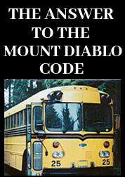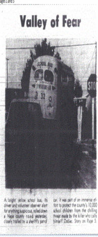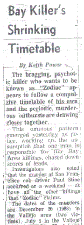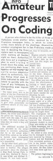
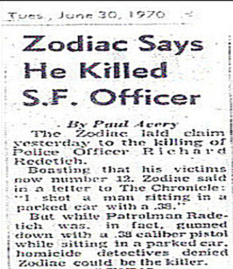
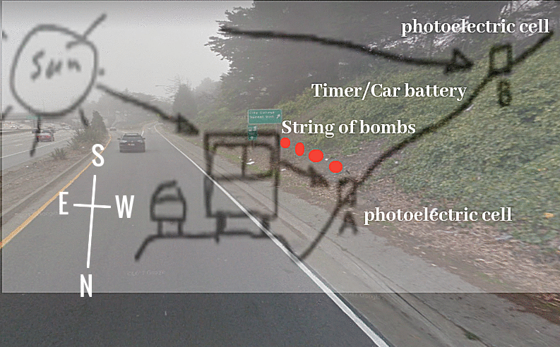
The Zodiac Killer gave us two working electrical circuits in his November 9th 1969 and April 20th 1970 bomb diagrams, threatening to blow up school buses in California. But how familiar was the Zodiac Killer when it came to circuitry and electronics? Did his profession require a knowledge of electronics, or did he simply copy the bomb-making designs from the publications he read?
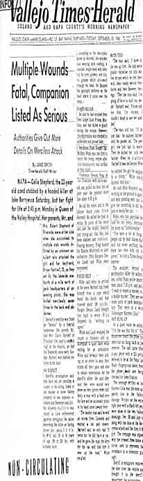
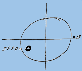
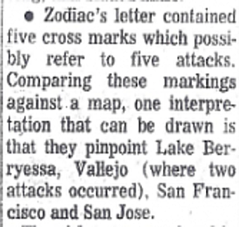
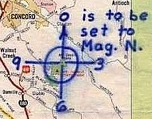
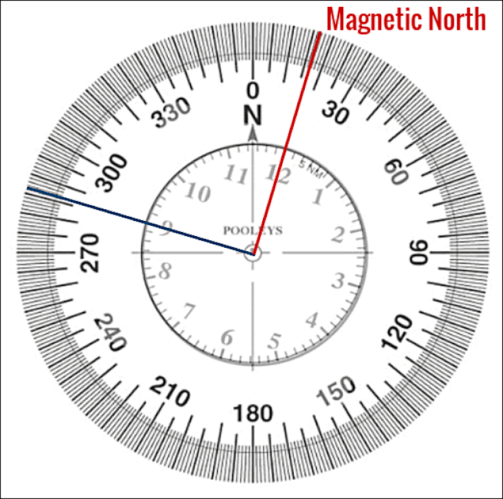
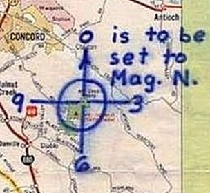
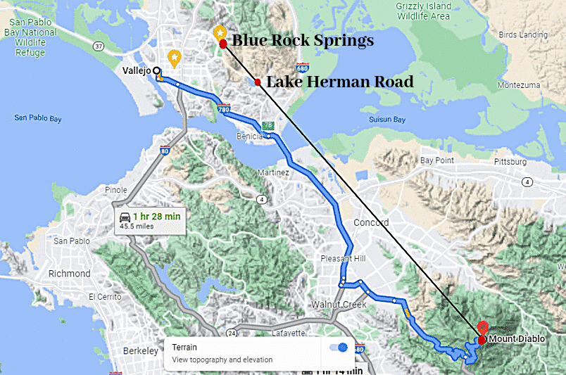
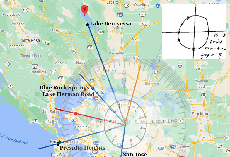
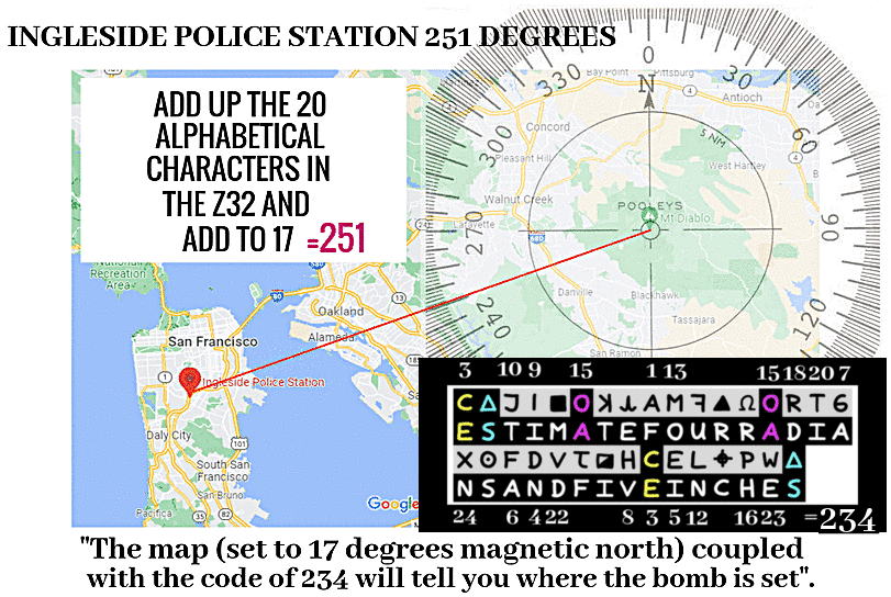
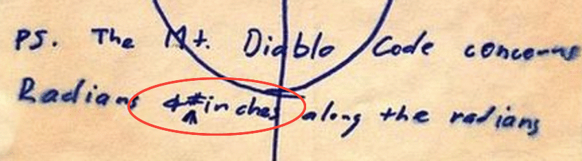
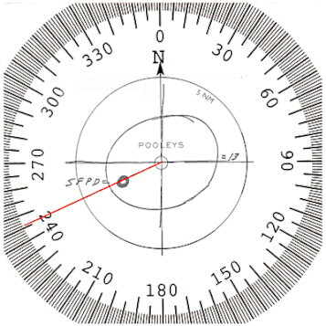
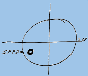
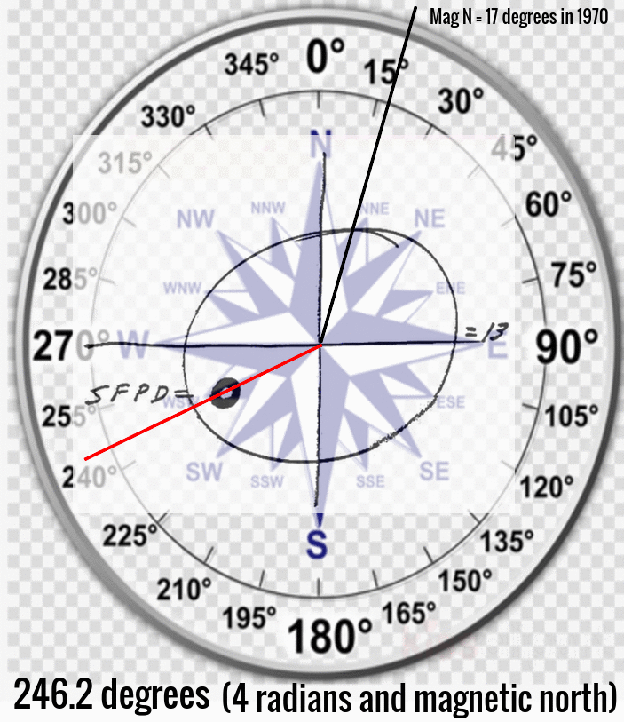
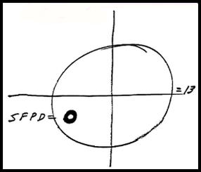
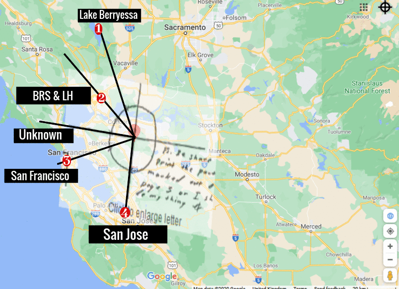
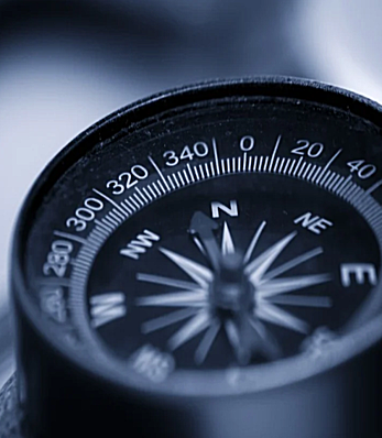
In the last article it was shown how the word "radians" began on the ciphertext symbol of Omega (in the Z32 code), taken from the concept that "The Mt. Diablo Code concerns Radians & # inches along the radians" formed the basis of the Z32 answer. When you consider that the Zodiac Killer placed a bold, black circle in his crosshairs with SFPD alongside (in his Little List letter), positioned at 4 radians and magnetic north, it becomes fairly obvious that the target was San Francisco. Only "four radians and five inches" fell inside San Francisco using the map scale provided.
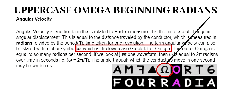
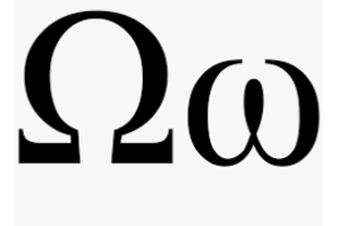
If the Zodiac Killer was fairly adept in his knowledge of electrical circuits (having used the term radians), he would have known that "Radians and angular velocity are terms that are commonly used in AC theory and AC measurement. Most of the electric energy used commercially is generated as Alternating Current (AC). The main reason Alternating Current is used is that alternating voltage may be easily raised or lowered in value. This is a tremendous advantage in electrical distribution systems, allowing AC power to be generated and distributed at a high voltage and reduced to a more practical voltage at the load". Link to the Electronics Technician Training website. The Zodiac Killer would likely have known that "angular velocity" is represented by the lowercase Omega sign (ω), and that "angular velocity is another term that's related to Radian measure. Therefore, Omega is equal to so many radians per second. It is the time rate of change in angular displacement. This is equal to the distance traveled by the conductor, which is measured in radians, divided by the period (T), time taken for one revolution". So did the Zodiac Killer use the uppercase Omega sign as a subtle clue to "radians", bearing in mind the Z32 was comprised of uppercase letters?
In the last article it was shown how the word "radians" began on the ciphertext symbol of Omega (in the Z32 code), taken from the concept that "The Mt. Diablo Code concerns Radians & # inches along the radians" formed the basis of the Z32 answer. When you consider that the Zodiac Killer placed a bold, black circle in his crosshairs with SFPD alongside (in his Little List letter), positioned at 4 radians and magnetic north, it becomes fairly obvious that the target was San Francisco. Only "four radians and five inches" fell inside San Francisco using the map scale provided.
If the Zodiac Killer was fairly adept in his knowledge of electrical circuits (having used the term radians), he would have known that "Radians and angular velocity are terms that are commonly used in AC theory and AC measurement. Most of the electric energy used commercially is generated as Alternating Current (AC). The main reason Alternating Current is used is that alternating voltage may be easily raised or lowered in value. This is a tremendous advantage in electrical distribution systems, allowing AC power to be generated and distributed at a high voltage and reduced to a more practical voltage at the load". Link to the Electronics Technician Training website. The Zodiac Killer would likely have known that "angular velocity" is represented by the lowercase Omega sign (ω), and that "angular velocity is another term that's related to Radian measure. Therefore, Omega is equal to so many radians per second. It is the time rate of change in angular displacement. This is equal to the distance traveled by the conductor, which is measured in radians, divided by the period (T), time taken for one revolution". So did the Zodiac Killer use the uppercase Omega sign as a subtle clue to "radians", bearing in mind the Z32 was comprised of uppercase letters?

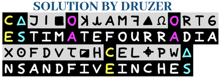
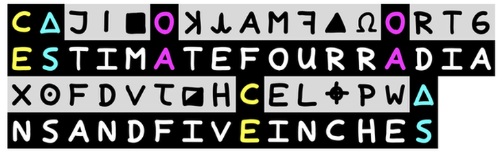
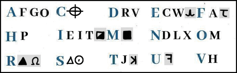
With 29 different characters in the code, they effectively serve no purpose in finding a solution using standard cryptographic methods. The solution above only relies (possibly) on the positioning of the Omega sign and the three repeating characters. The other 25 characters appear to be meaningless. They could be anything.
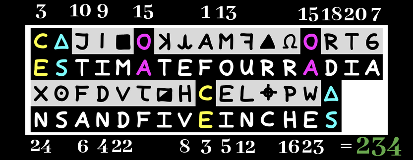
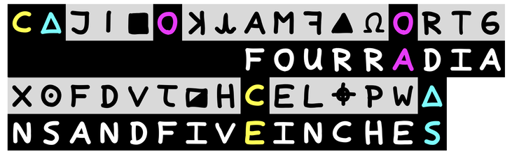
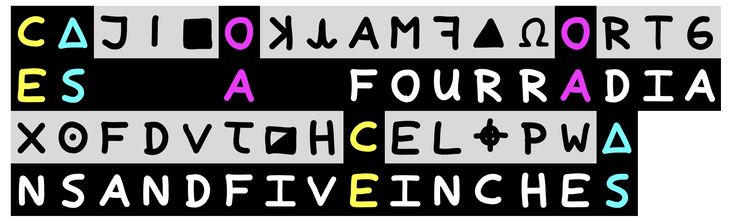
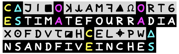
Therefore, if we go with the hunch that the "radians" word begins on the Omega part of the code (see above), how likely is it that "radians and five inches" would perfectly complete the Z32 code from character 13 to character 32. All we have to do then is add the word "four" before "radians" to complete characters 9 to 12, thereby creating "four radians and five inches" (from character 9 to character 32). Then we have to fill in the three repeating ciphertext characters with the plaintext characters of E, S and A. The answer of "estimate" is now fairly obvious, bearing in mind the target chosen by the Zodiac Killer was extremely unlikely to have fell on an exact amount of radians and inches. It could be argued that the Zodiac Killer gave us the three repeating ciphertext characters within the word "estimate", to give us a chance at uncovering the final part of the solution. The rest of the solution he had already given us in the phrase "The Mt. Diablo Code concerns Radians & # inches along the radians".."The Mt. Diablo Code concerns (FOUR) RADIANS & # (FIVE) INCHES along the radians".
Despite this concept being obvious once presented, the idea was undoubtedly a brilliant discovery by Zodiac researcher, Druzer, who unfortunately will never get the credit he deserves. This discovery, while incredibly easy to present, required somebody of the caliber of Druzer to unearth the answer. The simplicity of this solution is its strength, when compared to the fantastical and convoluted presentations you will encounter throughout the internet. Did the Zodiac Killer just read this information from the various publications that came his way, or did he have an intrinsic knowledge of electrical circuitry, so enabling him to create fully functioning bomb-making diagrams?
Despite this concept being obvious once presented, the idea was undoubtedly a brilliant discovery by Zodiac researcher, Druzer, who unfortunately will never get the credit he deserves. This discovery, while incredibly easy to present, required somebody of the caliber of Druzer to unearth the answer. The simplicity of this solution is its strength, when compared to the fantastical and convoluted presentations you will encounter throughout the internet. Did the Zodiac Killer just read this information from the various publications that came his way, or did he have an intrinsic knowledge of electrical circuitry, so enabling him to create fully functioning bomb-making diagrams?


 RSS Feed