 Dennis Rader (BTK)
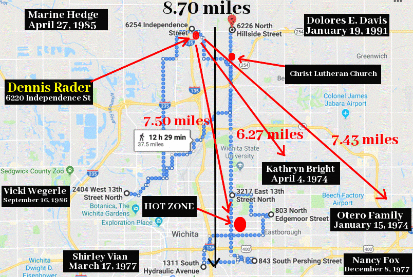
 Dennis Rader was responsible for 10 murders and 7 attacks from 1974 to 1991, that included in chronological order the Otero family, Kathryn Bright, Shirley Vian, Nancy Fox, Marine Hedge, Vicki Wegerle and Dolores E. Davis. He was eventually arrested near his home in Park City, Wichita on February 25th 2005. Below I have placed his murders on a map of Wichita and highlighted his home residence and the Christ Lutheran Church where he was president of the church council. The distances on the map show that he never ventured more than 9 miles from his home residence, and for the most part (except for two of his last three murders) gave himself a buffer zone of at least 6.27 miles for five of his attacks. The murders of Marine Hedge and Dolores E. Davis much closer to his home residence. The hot zone, represented by a search cost of 0% is shown by the large red dot on the map. This hot zone, predicted as where Dennis Rader most likely lived, was in the College Hill District of Wichita, exactly 7.50 miles from his home residence at 6220 Independence Street, Park City (subsequently bulldozed). His residence had a search cost of about 15% on a scale of 0 to 100%. So this would be described as a fairly warm zone.
Suspects are ranked based on their search cost—the percentage of the map searched before reaching the suspect’s anchor point. The search is conducted from the highest point of probability to the lowest; therefore, the lower the search cost, the more viable the suspect. If the geographic profile is accurate, the offender will have a low search cost. In the case of search cost, “map” refers to only the portion of the profile containing the crime scenes. As a result, suspects can have a search cost greater than 100%, which means a space larger than the area containing the crime scenes would have to be searched before reaching their anchor point. link. Here is a link to the Dennis Rader geoprofile using the Kim Rossmo model. geographicprofile.com.
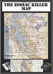
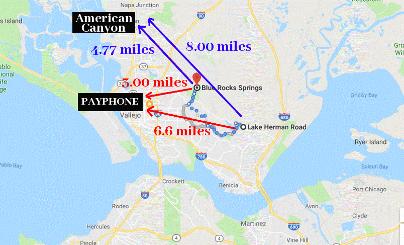
So, if the Zodiac lived in one of the hot zones just east of American Canyon, let us compare the distances Zodiac would have traveled to his first two attack sites. As the crow flies, Lake Herman Road is 8.00 miles from American Canyon, wheres Blue Rock Springs Park is 4.77 miles. Compare this to the 7.43 miles and 6.27 miles traveled by Dennis Rader for his first two attacks. In total (both attacks) Dennis Rader traveled 13.70 miles. If the Zodiac Killer lived in American Canyon, he would have traveled a total of 12.77 miles (a difference of just 0.93 miles). The Zodiac Killer and Dennis Rader both sought the attention of the newspapers and media, but can both be compared using the Rigel software system of geographic profiling?


 RSS Feed


