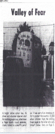
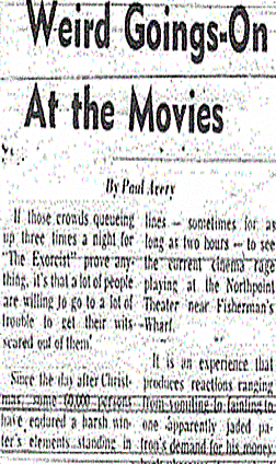
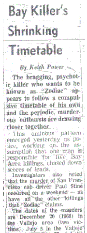
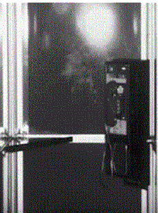
With little progress in the Zodiac case, often we have to return to what we already know but examine it in more depth. The search for the Zodiac Killer has broadened as the years have passed, with ever more suspects being introduced into the fold, effectively diluting the identity of the real murderer. The bigger the haystack becomes, the harder the needle is to find. One, if not the best clue in the Zodiac case, is the phone call he made from the intersection of Springs and Tuolumne at 12:40 am on July 5th 1969, approximately 40 minutes after the attack at Blue Rock Springs Park - particularly in light of a journey that should have taken slightly less than 10 minutes. What did he do during this time period? We cannot rule out that he just sat in his vehicle for the entire duration, but if the killer lived nearby, then separating himself from the weapon and any blooded clothing, before making a risky phone call so close to the police station, appeared to be the sensible option. It has already been surmised that the killer may be local to the area, due to the fact he seemed aware that Blue Rock Springs Park and Lake Herman Road were a good place to target couples or lone individuals in the night.
If the Zodiac Killer had lived in San Francisco, then he could have made this phone call anywhere en route back to his residence. There would appear little reason to sit closer to the crime scene than separate yourself from it, especially loaded down with incriminating evidence. The journey time back to San Francisco is approximately 40 minutes, with innumerable payphones on the way, and so negating the logic of remaining in the danger zone - unless of course you lived in Vallejo and were determined to make a call to police no matter.
If the Zodiac Killer had lived in San Francisco, then he could have made this phone call anywhere en route back to his residence. There would appear little reason to sit closer to the crime scene than separate yourself from it, especially loaded down with incriminating evidence. The journey time back to San Francisco is approximately 40 minutes, with innumerable payphones on the way, and so negating the logic of remaining in the danger zone - unless of course you lived in Vallejo and were determined to make a call to police no matter.

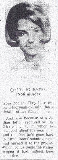
Kim Rossmo, who pioneered the science of geographical profiling, made an important observation that the killer exhibited target selection at Presidio Heights as opposed to his first three crimes, where the location was the overriding consideration. If we believe the Zodiac Killer to be a resident of Vallejo or Benicia and less familiar with the San Francisco area, then control would be the order of the day and his 'search attempts' in alien surroundings are less certain. He could not afford to travel around looking for victims without designated prime locations and expect to escape with any surety, thereby he targeted the victim first and took him to a predetermined location, as opposed to the location being the prime requisite. In the Lake Herman Road and Blue Rock Springs attacks, he frequented known locations to find a victim, whereas in San Francisco he searched for a victim and took him to a location. Kim Rossmo states that 'criminals who travel longer distances to offend are less likely to use uncertain target selection techniques'.
The Zodiac Killer knew Lake Herman Road and Blue Rock Springs Park were secluded locations and knew that by cruising between these two areas he would eventually find his moment to strike, shrouded by the darkness and limited traffic. Using the software Rigel, Kim Rossmo entered in various details in the Zodiac case, some of which were the murder locations, travel routes and phone calls - and came up with some key areas of interest. These areas were [1] southeastern Napa County, including American Canyon and north Vallejo. [2] eastern Solano County, including east and north Vallejo, Mare Island and Benicia. [3] northern Contra Costa County, just south of the Carquinez Strait, including Crockett.
All of these areas are viable destinations to reach from Blue Rock Springs Park and back to the Springs and Tuolumne intersection in 40 minutes to make the phone call to police. This is good news, but we need to narrow the field of view even further and begin with the most likely first, before extending outward.
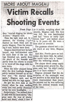
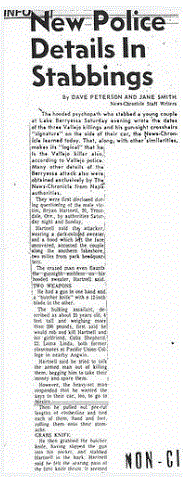
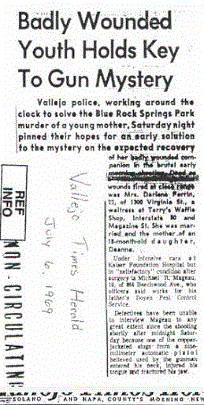
In a recent re-examination of the Lake Herman Road murders, it was possible to open up the timeline of James Owen and Stella Borges to 12 minutes, to enable the Zodiac Killer to head to Vallejo after exiting the turnout and pass by the Borges Ranch before she entered Lake Herman Road in her vehicle. Michael Mageau stated the killer exited the Blue Rock Springs parking lot and headed in the direction of Ascot Parkway, Tennessee Street and Springs Road, so we could have the Zodiac approaching the same exit of Columbus Parkway on both occasions, heading in the direction of central Vallejo. However, with the many inconsistencies in Michael Mageau's testimony, we cannot be certain which direction the Zodiac traveled after leaving the parking lot.
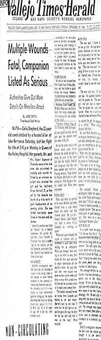
We know that killers often employ a 'buffer zone' from their residence and we know that with increased confidence, a serial killer will move from their comfort zone further afield. Often though, their initial crimes start closer to home. This is why the Lake Herman Road and Blue Rock Springs Park crimes, separated by only 3.9 miles, are of paramount importance. Additionally, both attacks fell on a Friday, which for somebody working a normal Monday to Friday, 9 to 5 job, would explain the lack of 'adventure', that was otherwise displayed at the Lake Berryessa and Presidio Heights attacks, which both fell on a Saturday. This is referred to as the 'least effort principle'. There is one particular area of interest (northern Vallejo), that we can examine for all the right reasons and also examine for all the wrong reasons.
We know that killers often employ a 'buffer zone' from their residence and we know that with increased confidence, a serial killer will move from their comfort zone further afield. Often though, their initial crimes start closer to home. This is why the Lake Herman Road and Blue Rock Springs Park crimes, separated by only 3.9 miles, are of paramount importance. Additionally, both attacks fell on a Friday, which for somebody working a normal Monday to Friday, 9 to 5 job, would explain the lack of 'adventure', that was otherwise displayed at the Lake Berryessa and Presidio Heights attacks, which both fell on a Saturday. This is referred to as the 'least effort principle'. There is one particular area of interest (northern Vallejo), that we can examine for all the right reasons and also examine for all the wrong reasons.
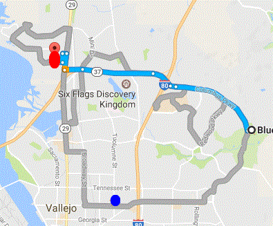
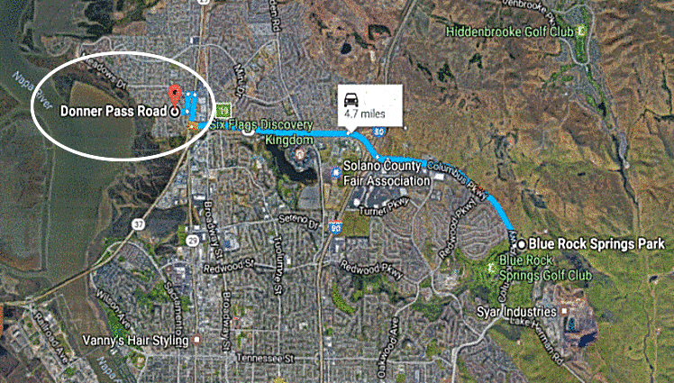
The area of interest is denoted by the red circle in the diagram on the left. The blue circle is the Springs and Tuolumne payphone. This area of interest is 4.7 miles from Blue Rock Springs Park (10 minutes). This area is 4.1 miles from the payphone (10 minutes). The times are approximated based on the route. A murderer leaving Blue Rock Springs at 12:04 am at the latest, with 15 minutes to hide the weapon and clothes at home, and ready himself before returning to the payphone, would arrive to make the phone call at 12:39 am. This area of interest is also in a direct line south from the 1231 Main Street, Napa payphone, only 12 miles away. It is situated 9 miles from Lake Herman Road.
In each case, a reasonable 'buffer zone' is employed from the crime scene at Lake Herman Road and Blue Rock Springs - and from both payphones - while still allowing the total journey time of 36-40 minutes to be achieved after the Blue Rock Springs crime. But in all cases, the 'buffer zone' is not too large either and a delicate balancing act that the killer may have factored into the equation.
Now we will focus on this area of interest for all the wrong reasons and the following must be taken with a huge pinch of salt.
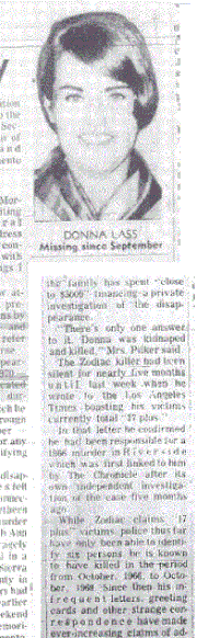
Donna Ann Lass disappeared from the Sahara Tahoe Hotel and Casino on September 6th 1970, and was presumably highlighted by the Zodiac Killer in the March 22nd 1971 'Pines' card. The card itself indicated a location, thought to be the burial site of Donna Lass, although it was vague in nature, supplying what appeared to be directional markers. The text on the card read; [1] 'Sierra Club' [2] 'Sought Victim 12' [3] 'Peek through the pines' [4] 'pass Lake Tahoe areas' [5] 'around in the snow' (pasted upside down).
Two notable Sierra Club properties were identified. In a newspaper article it stated "the site depicted on the 'Pines' Card was from an advertisement published last Sunday by several newspapers. It was an artist's rendition of houses among the trees at a project at Incline Village", located at 895 Tanager Street, Nevada. The other was Clair Tappaan Lodge at 19940 Donner Pass Rd, Norden, highlighted as a potential burial site and investigated by police officer Harvey Hines. An excavation of the site was performed but no body was unearthed. It has been stated that a pair of sunglasses, that may have belonged to Donna Lass were found (but this cannot be verified). The directions on the 'Pines' card, if from the Sahara Tahoe Hotel, seems to indicate that we have to pass some 'lake tahoe areas', traveling on the lake's western shore, along California State Route 89, which brings us out by Truckee, only 2 miles from the Donner Memorial State Park, and a few miles east of Clair Tappaan Lodge.
Here is an overhead view of Clair Tappaan Lodge on Google maps. Now let us drop to the roadside and 'peek through the pines' at Clair Tappaan Lodge. Whether the Zodiac Killer was using a play on words, possibly bringing us out by the Donner Memorial State Park and suggesting she could be found in this area, only he knows. Or was his play on words suggestive of somewhere entirely different. As stated above, Clair Tappaan Lodge is situated alongside Donner Pass Road, but are we in the wrong place, and does the clue point towards a totally different area, somewhere we are much more familiar with. Somewhere only 4.7 miles from Blue Rock Springs Park. Probably not.
In each case, a reasonable 'buffer zone' is employed from the crime scene at Lake Herman Road and Blue Rock Springs - and from both payphones - while still allowing the total journey time of 36-40 minutes to be achieved after the Blue Rock Springs crime. But in all cases, the 'buffer zone' is not too large either and a delicate balancing act that the killer may have factored into the equation.
Now we will focus on this area of interest for all the wrong reasons and the following must be taken with a huge pinch of salt.
Donna Ann Lass disappeared from the Sahara Tahoe Hotel and Casino on September 6th 1970, and was presumably highlighted by the Zodiac Killer in the March 22nd 1971 'Pines' card. The card itself indicated a location, thought to be the burial site of Donna Lass, although it was vague in nature, supplying what appeared to be directional markers. The text on the card read; [1] 'Sierra Club' [2] 'Sought Victim 12' [3] 'Peek through the pines' [4] 'pass Lake Tahoe areas' [5] 'around in the snow' (pasted upside down).
Two notable Sierra Club properties were identified. In a newspaper article it stated "the site depicted on the 'Pines' Card was from an advertisement published last Sunday by several newspapers. It was an artist's rendition of houses among the trees at a project at Incline Village", located at 895 Tanager Street, Nevada. The other was Clair Tappaan Lodge at 19940 Donner Pass Rd, Norden, highlighted as a potential burial site and investigated by police officer Harvey Hines. An excavation of the site was performed but no body was unearthed. It has been stated that a pair of sunglasses, that may have belonged to Donna Lass were found (but this cannot be verified). The directions on the 'Pines' card, if from the Sahara Tahoe Hotel, seems to indicate that we have to pass some 'lake tahoe areas', traveling on the lake's western shore, along California State Route 89, which brings us out by Truckee, only 2 miles from the Donner Memorial State Park, and a few miles east of Clair Tappaan Lodge.
Here is an overhead view of Clair Tappaan Lodge on Google maps. Now let us drop to the roadside and 'peek through the pines' at Clair Tappaan Lodge. Whether the Zodiac Killer was using a play on words, possibly bringing us out by the Donner Memorial State Park and suggesting she could be found in this area, only he knows. Or was his play on words suggestive of somewhere entirely different. As stated above, Clair Tappaan Lodge is situated alongside Donner Pass Road, but are we in the wrong place, and does the clue point towards a totally different area, somewhere we are much more familiar with. Somewhere only 4.7 miles from Blue Rock Springs Park. Probably not.


 RSS Feed